As well as being a popular picnic spot, Sharplin Falls car park is one of the starting points for the Mt Somers Tracks which provides a number of day walks and multi-day tramps.
Sharplin Falls car park has a shelter, toilets and an information panel.
Sharplin Falls Track
| Distance: | 45 minutes, 1.2 km one way |
| Classification: |
Walking Track |
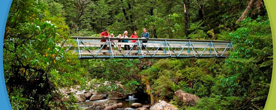
| About the walk: | The bridge in the above photo is easily accessed from the carpark. On the other side of the bridge the well formed track follows the stream before climbing up through beech forest. Sharplin Falls, named after an early Staveley sawyer, drop several metres over the Mt Somers southern fault system. |
Sharplin Falls Track junction to Pinnacles Hut
| Distance: | 3 hours, 5.2 km one way |
| Classification: |
Easy Tramping Track |
| About the walk: | From Sharplin Falls Track junction the path climbs steeply up to Duke Knob before following Bowyers Stream to the hut. |
Collect a Mt Somers Track brochure from the Methven i-SITE Visitor Centre.
View My Planner
New Zealand
Phone: +64 3 302 81725 | Fax: +64 3 302 8954
![]()
Free advice from travellers for a great Methven vacation.