In 1983 Mt Somers and Staveley locals formed the Mt Somers Walkways Society. This led to the creation of what is now known as the Mt Somers Track. The track officially opened in 1987, the year the management of the area passed to the Department of Conservation (DOC). Since then there has been a close association between the two organisations. Mt Somers Track; a 1–2 day tramp links the popular Pinnacles and Woolshed Creek huts and provides a circuit around Mt Somers. There are other walks from 30 minutes to four hours amongst impressive volcanic rock formations, historic mines and shady forest trees.
Woolshed Creek picnic area (marker 1) has a large grassy, sheltered picnic area with toilets and information. Sharplin Falls car park (marker 2) has a shelter, toilets and an information panel.
Woolshed Creek Hut sleeps 26 on sleeping platforms while Pinnacles Hut sleeps 19 on single and double bunks. Water is supplied from either a rainwater tank or directly from a stream. All drinking water should be sterilised, filtered or boiled for three minutes before use. Both huts have a wood or coal burner for heating but cooking facilities and utensils are not provided. Back country hut tickets should be bought in advance from Mt Somers or Staveley stores, Methven i-SITE Visitor Centre or any DOC office. Annual hut passes (available from DOC offices) may also be used. Huts cannot be booked and they sometimes become overcrowded; please be considerate of other users.
If you are intending to walk only one way and require vehicle transport, contact the Staveley Store (phone: 03 303 0859) before you start your trip.
Sharplin Falls Track
| Distance: | 45 minutes, 1.2 km one way |
| Classification: |
Walking Track |
| About the walk: | This track passes through beech forest. Sharplin Falls, named after an early Staveley sawyer, drop several metres over the Mt Somers southern fault system. |
Sharplin Falls Track junction to Pinnacles Hut
| Distance: | 3 hours, 5.2 km one way |
| Classification: |
Easy Tramping Track |
| About the walk: | From Sharplin Falls Track junction the path climbs steeply up to Duke Knob before following Bowyers Stream to the hut. |
Pinnacles Hut to Woolshed Creek Hut
| Distance: | 3 hours, 6.2 km one way |
| Classification: |
Easy Tramping Track |
| About the walk: |
Pinnacles Hut is named after the rock formations on the northern face of Mt Somers, formed by the cooling of very hot sticky lava flows some 90 million years ago. From the hut follow markers through tussock and subalpine scrub to Mt Somers saddle. It is a steady climb to the saddle, from which views of the Taylor and Old Man ranges dominate the scenery. On the descent towards Morgan Stream a sign indicates a short side-trip to view some interesting boulder features referred to as ‘caves’. Returning to the main track, follow the markers across Morgan Stream and Woolshed Creek to Woolshed Creek Hut. |
Woolshed Creek Hut to Woolshed Creek car park via Miners Track
| Distance: | 3 hours, 5 km one way |
| Classification: |
Easy Tramping Track |
| About the walk: | From the hut the track rises to a high point (934 m) with superb views of the upper Ashburton Gorge, before descending to the old Blackburn Mine. You will see the hand-built jig that transported coal from the mine to the railway wagons waiting below. At the bottom of the jig the track follows the route of the tramway to Woolshed Creek car park. |
Woolshed Creek Hut to Rhyolite Ridge Track junction via Mt Somers Track (sth face)
| Distance: | 2 hours, 4.6 km |
| Classification: |
Tramping Track |
| About the walk: | The route takes in dynamic scenery with regenerating mountain beech forest/tawhairauriki within a landscape of waterfalls, deep icy pools and rocky tors. From the hut the route climbs some 500 metres to a local feature known as the Bus Stop Overhang. From here the track crosses the face of Mt Somers to link with Rhyolite Ridge Track. |
Rhyolite Ridge Track junction to Mt Somers Summit Track junction
| Distance: | 3 hours 30 min, 6 km |
| Classification: |
Tramping Track |
| About the walk: |
Passing around the southern face of Mt Somers through a mix of open grassland and forested catchments, this section of track eventually rises to its highest point (1080 m) at the junction of Mt Somers Summit Track. Acland Shelter provides welcome shelter and rest after about 4 km (1 hour 30 min) from the junction. |
Mt Somers Summit Track junction to Sharplin Falls car park
| Distance: | 2 hours 30 min, 2.7 km one way |
| Classification: |
Tramping Track |
| About the walk: | The final steep downhill section is through regenerating forest areas but is open enough to continue to provide interesting views to the east |
Nature Trail
| Distance: | 30 minutes, 1 km onw way |
| Classification: |
Walking Track |
| About the walk: |
Cross the bridge over Woolshed Creek before continuing up the true left of Woolshed Creek. The river is then forded* before climbing out through the dross (old coal dust) screened from coal at the bottom of the jig before returning to Woolshed Creek car park. *Take care fording the river, if in doubt return the way you came |
Rhyolite Ridge Track
| Distance: | 1 hour, 1.8 km one way |
| Classification: |
Tramping Track |
| About the walk: | Follows a rocky ridge linking Mt Somers Track (south face), with Woolshed Creek car park. |
Sidewinder Track
| Distance: | 45 minutes, 1 km |
| Classification: |
Easy Tramping Track |
| About the walk: | This steep hill track begins with a short walk through small pocket of silver beech/tawhai that escaped the fires that swept through Ashburton Gorge. The track climbs steeply up to and through the tailings of the Blackburn Mine where it links with Miners Track to provide either a return trip back to the Woolshed Creek car a chance to continue on to Woolshed Creek Hut. |
Mt Somers Summit / Te kiekie Summit
| Classification: |
Tramping Track |
| About the walk: |
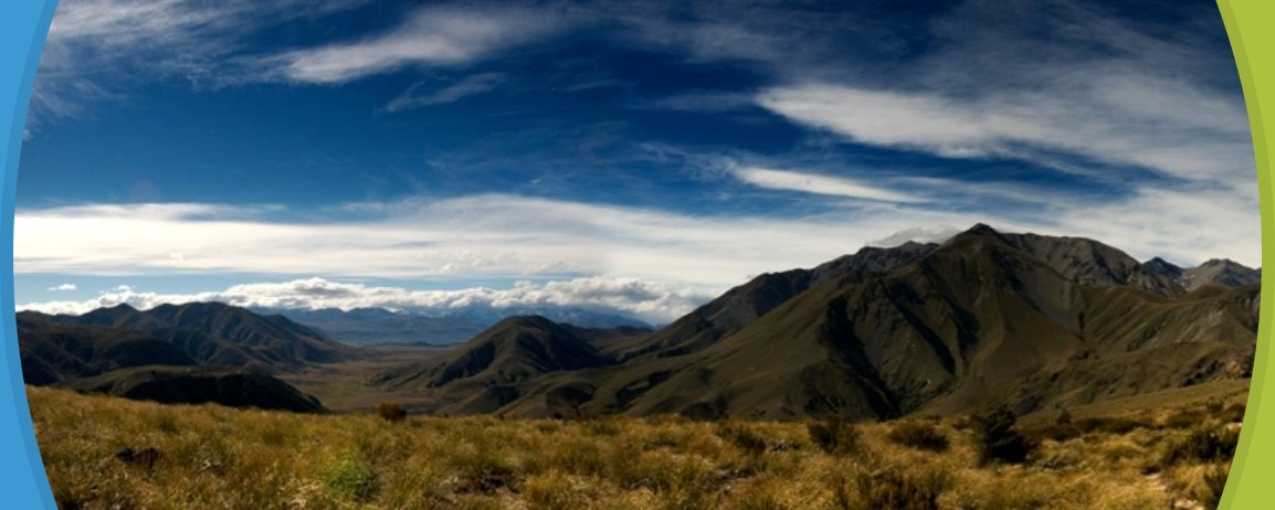
The summit (1687 m) and its surrounding plateau is worthy of a visit, with 360-degree views of the surrounding mountains and coastal plain. From Woolshed Creek car park follow Rhyolite Ridge Track then along the high plateau (unmarked). From Sharplin Falls car park it is a 5-hour one-way trip to the summit (4.7 km). In winter this face gets very little sunlight making the snow hard and icy. An ice axe, crampons, and some mountaineering experience are required to reach the summit. |
Collect a DOC Mt Somers Track brochure from the Methven i-SITE Visitor Centre.
View My Planner
New Zealand
Phone: +64 3 302 81725 | Fax: +64 3 302 8954
![]()
Free advice from travellers for a great Methven vacation.