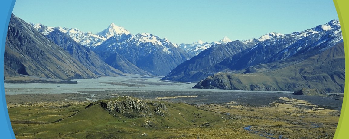
Hakatere Conservation Park covers nearly 60,000 hectares of rugged mountain country, tussocklands, beech forest and sparkling clear rivers and lakes between two mighty rivers the Rakaia and Rangitata.
The headwaters of both rivers are notable landscapes, including the upper Rangitata which featured in the Lord of the Rings films (Mount Sunday was a location for Edoras). Other distinctive features are kettleholes (depressions), found largely in the eastern South Island high country.
The park has the potential to grow to become the largest conservation park in New Zealand.
The popular 2-3 day sub-alpine Mt Somers Track, an easy tramping track, falls within the park.
Scattered throughout the park are a number of huts and bivouacs, most of which are accessed via unmarked routes following riverbeds. The upper Rakaia huts have a high level route (Glenfalloch Route) marked by poles. This route can be used when weather conditions and high rivers make riverbed travel impossible.
Stour River
A car park on Ashburton Gorge Road at the Stour River bridge is at the start of a track up the river to the public conservation land (3 km). The track gives easy access to Lake Emily (15 km) or to Manuka Hut (17 km).
Mt Barrosa access
An easement marked from a small car park on Ashburton Gorge Road about 500 m east of Blowing Point Bridge gives access to the public conservation land after a walk of 780 m.
Collect a Hakatere Conservation Park brochure from the Methven i-SITE Visitor Centre.
View My Planner
New Zealand
Phone: +64 3 302 81725 | Fax: +64 3 302 8954
![]()
Free advice from travellers for a great Methven vacation.